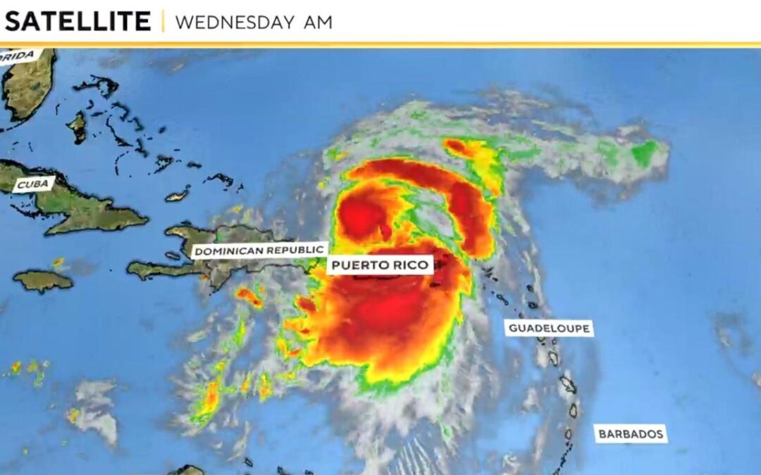
Hurricane Ernesto has now formed in the Atlantic, the National Hurricane Center said in its 11 a.m. update on Wednesday. Packing 75 mph winds, the storm is churning north of Puerto Rico, where “significant flooding” is likely.
The storm developed just days after Debby finished its trek along the U.S. East Coast.
Ernesto had remained a tropical storm through most of the morning, reaching hurricane status once its winds reached the minimum 74 mph for classification, as measured by the Saffir-Simpson Wind Scale. This scale does not account for a storm’s size, speed, precipitation or storm surge, all of which pose additional dangers.
According to PowerOutage.us, Ernesto has left nearly 46,000 people in the Virgin Islands without power, including everyone on the island of St. Croix and nearly everyone on the islands of St. Thomas and St. John. More than 660,000 in Puerto Rico are also without power, according to island energy provider LUMA Energy.
Ernesto, currently moving at about 16 mph, is expected to continue strengthening in the coming days. The hurricane center predicted earlier in the morning that it could become a major hurricane, which is when a storm reaches Category 3, with winds of 111 mph or higher.
President Biden approved an emergency declaration for Puerto Rico, the White House said Tuesday night, authorizing FEMA to help with storm recovery.
“On the forecast track,” the Miami-based hurricane center said in its latest update, “the center of Ernesto will continue to move away from Puerto Rico today, move across the western Atlantic during the next few days, and approach Bermuda Friday and Saturday.”
A tropical storm warning is in effect for the U.S. and British Virgin Islands and Puerto Rico and its islands of Vieques and Culebra. The previous hurricane watch for the BVI has been discontinued, and forecasters said that Bermuda should monitor the storm’s progress and that a hurricane watch may be needed for the island later on Wednesday.
CBS News senior weather and climate producer David Parkinson said Wednesday that even though Ernesto is dozens of miles away from Puerto Rico, its back end “is still hammering the island with torrential downpours.”
The hurricane center said the storm is expected to produce between 4 and 6 inches of rain over the U.S. and British Virgin Islands and up to 10 inches across southeastern Puerto Rico. Parkinson noted Wednesday morning that more than half a foot of rain has already fallen in Culebra and Vieques “with another inch or two to go.”
That amount of precipitation is causing rivers to overflow. Puerto Rico’s Rio Grande de Loiza “may spill out of its banks” in the next few hours, Parkinson said, while elsewhere on the island, “Rio Blanco’s gauge went parabolic this morning, going from 6 to 16 feet in less than 90 minutes.”
“The positive news is that the river has fallen nearly as quickly as it has risen, and is down to 10 feet,” Parkinson said. “That will likely be the story all across the island. The rivers won’t stay above flood stage for very long, but they will cause brief major flooding.”
Flash flooding and mudslides could occur in the U.S. territories, the hurricane center said.
While the U.S. mainland is largely outside of the risk zone for Ernesto, Parkinson said that it could bring rip currents and larger waves to the coast. The northeast, he said, could see 8-foot waves over the weekend and the Carolinas — still recovering from Tropical Storm Debby — could see a swell build starting tomorrow.
NOAA forecasters issued a similar warning, saying that “beach goers should be aware of a significant risk of life-threatening surf and rip currents, and stay out of the water if advised by lifeguards.”
Ernesto marks the fifth named storm so far of the Atlantic hurricane season, which has already proven to be historic after Beryl reached record strength at the beginning of the season in above-average temperatures of the Gulf of Mexico. NOAA has predicted an above-normal season, with 17-25 named storms, eight to 13 hurricanes, and four to seven major hurricanes.
The fifth-named storm typically doesn’t form until Aug. 22, according to NOAA.


